
Top 5 Self-Drive Safari Routes in Tanzania (2025-26 Guide)
We have looked at the top destinations to visit while in Tanzania, highlighting the top 5 self drive Safari route and the places you can visit on each route to help you choose from during this great adventure.
Why Self-Drive in Tanzania?
For those seeking the freedom of the open road, Tanzania provides one of the most authentic and flexible safari experiences in Africa. Both seasoned safari travelers and those who have never been on a safari before are flocking to areas with well-established national parks, welcoming communities, and breathtaking scenery for self-drive safaris.
If you are looking to see the Great Migration, the Great Rift Valley, or some untouched nature on your self-drive safari in Tanzania, these are the five routes you should take.
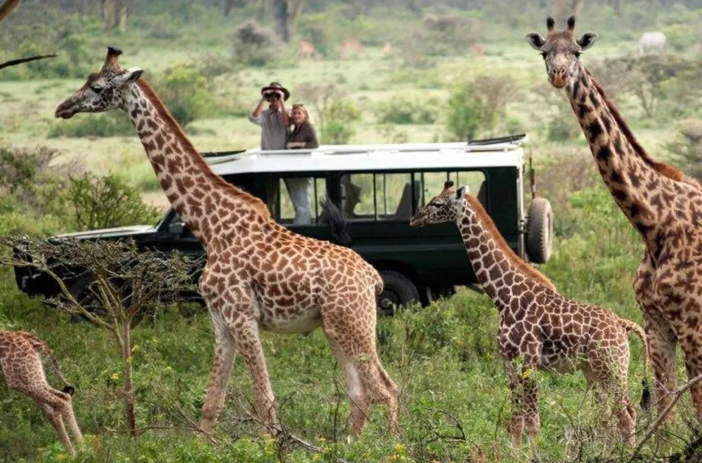
1. The Northern Circuit: Arusha – Tarangire – Ngorongoro – Serengeti – Lake Natron-Lake Manyara- Kilimanjaro
Highlights:
- Big five viewing
- wildebeest migration (June to October- Mara river crossing in northern Serengeti) and (December to March – Calving season in Ndutu area)
- Crater floor wildlife concentration
- hiking mount Kilimanjaro (the highest mountain on African continent)
Distance: ~1,500 km
Fuel Consumption: 220Litres +/-
Recommended Duration: 14–20 days
Best Time to Visit: June to October (dry season)
Suggested Route:
-
Arusha – The starting point for your safari. make sure that you do your shopping before departing the city
-
Tarangire National Park – The park is a home to big cats, elephants and baobab trees
-
Lake Manyara – A home to tree climbing lions and and good place for family activities
-
Ngorongoro Crater –The UNESCO World Heritage Site is a home to all the big five of africa besides being the biggest caldera in the world.
-
Serengeti National Park – Seronera area (central serengeti) is an all year round area whereas the ndutu region is good for calving season and northern part is good between june and october during the migration
-
Lake Natron – flamingos, waterfalls, and volcanic views and hiking ol donyoi mountain.
- Kilimanjaro mountain– hiking tothe uhuru peak, the highest peak on the African continent.
- After Tarangire, the roads are mostly gravel or dirt.
- you Need to hire a 4×4 car, minimum a Prado
- In the event of rain, exercise caution along Natron, Ndutu, and Ngorongoro rim
- It is better to plan Kilimanjaro hike during dry season and ensure that you are fit enough for the experience.
Park fee approximate
- Ngorongoro transit-~71$ per person
- ngorongoro crater- ~300$ per vehicle
- ngorongoro camping fees- ~35$ per person
- serengeti entry- ~83$ per person
- serengeti camping fees- ~50$ per person
- tarangire entry- ~60$ per person
- tarangire camping- ~36$ per person
- lake Natron WMA- ~30$ per person
- kilimanjaro hiking (6 days)- ~2000$ per person
- vehicle entrance- ~20 to 40$ per day (depending on the vehicle weight)
2. Southern Circuit: Iringa – Ruaha National Park – Mikumi National Park – Nyerere National Park
Highlights:
-
Remote and less crowded
-
Large prides of lions and wild dogs
-
Beautiful baobab-studded scenery
Distance: ~1,700 km round trip from Dar es Salaam
Fuel Consumption: 220 liters
Recommended Duration: 10–12 days
Best Time: June to November
Suggested Route:
-
Dar es Salaam → Morogoro → Mikumi NP →Nyerere → Iringa → Ruaha NP → Dar es salaam
Road Conditions:
-
Paved roads to Mikumi
-
Gravel roads to Ruaha—dry season preferable
-
Limited fuel stations—stock up in Iringa
- for les driving, you can plan one way rental and fly from Iringa.
Park Fees:
-
Ruaha: ~$30–35 pp/day
-
Mikumi: ~$30 pp/day
- Nyerere: ~$83 pp/day
-
Lower than northern parks except for Nyerere national park
3. Western Circuit: Kigoma – Katavi National Park – Mahale Mountains National Park – Gombe stream National park
Highlights:
- remotely located with true off road experience
- chimpanzee trekking at Mahale and Gombe stream national park
- very low number of visitors partly due to its remoteness
Distance: ~2,500 km from Arusha/Dodoma
Recommended Duration: 10–15 days
Fuel Consumption: 320litres
Best Time: June to October
Suggested Route:
-
Arusha → Tabora → Mpanda → Katavi → Gombe stream → Mahale (access by boat)
Road Conditions:
-
Remote dirt roads—requires a well-equipped 4×4
-
Be prepared with extra fuel and supplies
Note: This route is for experienced over landers. we shall not guarantee road assistance on this route due to its remoteness.
4. Lake Natron Loop: Arusha – Mto wa Mbu – Lake Natron – Engaruka – Arusha
Highlights:
-
Lesser-known scenic route
-
Ol Doinyo Lengai volcano
-
Flamingos and waterfalls
- the route excludes wildlife viewing
Distance: ~450 km loop
Duration: 3–4 days
Fuel Consumption: 70 litres
Best Time: Year-round, but avoid heavy rains (March–May)
Route Details:
-
Arusha → Mto wa Mbu → Lake Natron → return via Engaruka escarpment
Road Conditions:
-
Dusty and bumpy—4×4 required and not a rav4 or Suzuki
-
Remote—minimal mobile signal and minimal fuel en route. ensure to refill in towns o avoid higher fuel prices
Tips:
-
Visit the hot springs and waterfalls
-
Use local guides for climbing Ol Doinyo Lengai
5. Usambara Mountains & Saadani NP (Beach & Safari Mix)
Highlights:
-
A combination of coastal wildlife and mountain scenery
-
Saadani is the only park with beach access
Distance: ~800 km loop from Dar es Salaam
Duration: 5–7 days
Fuel consumption: 150 litres
Best Time: June to November
Suggested Route:
-
Dar → Pangani → Saadani NP → Lushoto (Usambara Mountains)
Road Conditions:
-
Coastal roads can be sandy or flooded in rainy seasons
-
Lushoto roads are paved but winding
Why It’s Unique:
-
Combine wildlife viewing with beach relaxation and mountain hikes
Essential Tips for All Routes:
-
4×4 Required: All routes include unpaved sections. Preferred Land Cruisers 4×4.
-
Navigation: Use GPS and apps like Maps.me or Tracks4Africa. We supply our cars with Tracks4Africa maps.
-
Park Permits: Pay online via TANAPA or in advance. We can facilitate arranging your park entry fees in advance.
-
Fuel: Top up whenever possible—stations are far between in remote areas. Our cars come with a double tank for extended mileage driving.
-
Supplies: We provide extra water for use, two spare tires, a jack, and a compressor
-
Driving Laws: Left-hand driving; an international license is recommended
-
Emergency Numbers: Have local contacts and lodge support info on hand